DPaW Imagery
Processed Landsat imagery downloaded and processed to enable time series analysis and then access provided to users across State Government.

Area of science
Agricultural And Veterinary Sciences, Marine, Remote Sensing and Spatial Analysis
Systems used
Data Stores
Applications used
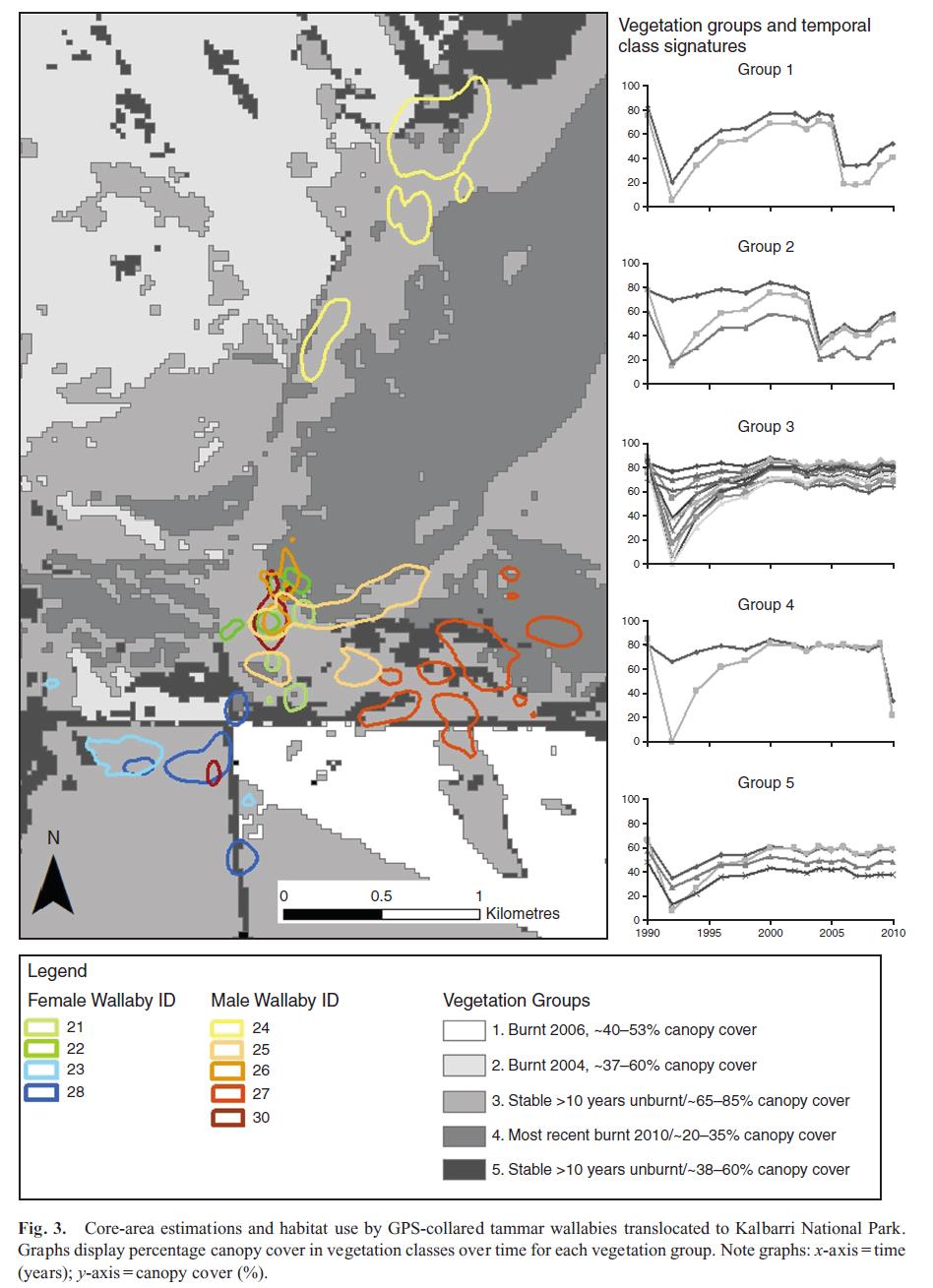
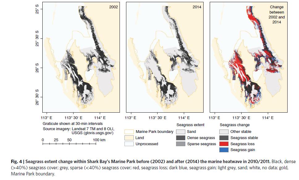
Time series analysis, fire mapping, vegetation monitoring, mangrove identification; habitat identification and monitoring; seagrass monitoringThe Challenge
Enable time series analysis of satellite data to improve government decision making. Across State government agencies are downloading satellite imagery and not applying consistent corrections for time series analysis. Duplication and inconsistent image processes are being applied. Data storage is an issue for agencies to build adequate image stacks for time series analysis.
The Solution
Central provision of satellite imagery, processed to a recognised standard to enable users to download and conduct time series analysis and other remote sensing analyses
The Outcome
Pawsey’s data centre provides a secure environment to share processed satellite imagery across State government
List of Publications
Arias-Ortiz, A., O. Serrano, P. Masqué, P. S. Lavery, U. Mueller, G. A. Kendrick, M. Rozaimi, et al. 2018. “A Marine Heatwave Drives Massive Losses from the World’s Largest Seagrass Carbon Stocks.” Nature Climate Change 8 (4): 338. https://doi.org/10.1038/s41558-018-0096-y.
Binks, Rachel M., Margaret Byrne, Kathryn McMahon, Georgina Pitt, Kathy Murray, and Richard D. Evans. 2019. “Habitat Discontinuities Form Strong Barriers to Gene Flow among Mangrove Populations, despite the Capacity for Long-Distance Dispersal.” Diversity and Distributions 25 (2): 298–309. https://doi.org/10.1111/ddi.12851.
Watkins, G. E., N. Willers, H. Raudino, J. Kinloch, and R. van Dongen. 2018. “Success Criteria Not Met, but Valuable Information Gained: Monitoring a Reintroduction of the Tammar Wallaby.” Wildlife Research 45 (5): 421. https://doi.org/10.1071/WR17102.