GSWA State Geophysical Compilation Grids
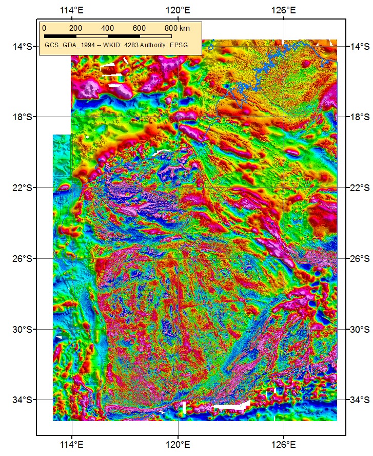
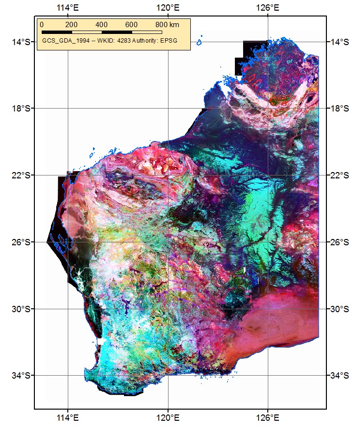
Delivery of Western Australia state raster (grid) coverages of magnetic, radiometric and gravity data compiled from numerous individual survey datasets held in the geophysics data repository at the Department of Mines, Industry Regulation and Safety. These compilation geophysical datasets complement other geoscientific datasets generated by the Geological Survey of Western Australia (GSWA) and are widely used by researchers in industry, academia and government.
Area of science
Geosciences
Systems used
Zeus, Nimbus and Managed Storage
Applications used
Downunder, eScriptThe Challenge
Exploration projects generation personnel and researchers rely on the availability regional scale compilations of geophysical data at the best resolution available in order to select areas for work and to provide context for the interpretation of detailed geoscience data acquisition programs. Making and updating such compilations from hundreds of individual surveys is a time-consuming process requiring the use of specialist software and is beyond the resources of most exploration geoscientists.
The Solution
The Geological Survey of Western Australia (GSWA) is a primary generator of regional scale geophysical data sets and also receives and holds the many survey datasets generated by exploration companies and submitted to the Western Australian Department of Mines, Industry Regulation and Safety under the terms of the WA Mining Act 1978. Therefore, GSWA is uniquely placed to undertake the process of creating and maintaining the regional compilations and making them available to explorationists and researchers. throughout Western Australia and all over the world.
The Outcome
The Western Australia 20 m, 40 m and 80 m-resolution magnetic and 80m-resolution radiometric grid compilations may still be the highest resolution coverages of these data types over such a large contiguous area that are publicly available anywhere in the world. The size of some of the datasets are too large to store and deliver via the Department’s ‘normal’ data stores. The Pawsey Data Store enables the delivery of these and other Western Australian geophysical compilations and large size hyperspectral datasets at download speeds not otherwise available from GSWA for smaller datasets.
List of Publications
Brett, JW 2018, 40 m magnetic merged grid of Western Australia 2018 version 1: Geological Survey of Western Australia, Perth.
Brett, JW 2020, 400 m gravity merged grid of Western Australia 2020 version 1: Geological Survey of Western Australia, Perth.
Brett, JW 2018, 80 m radiometric merged grids of Western Australia 2018 version 1: Geological Survey of Western Australia, Perth
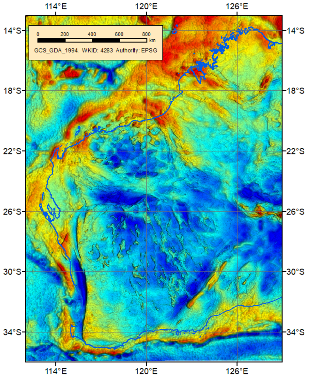
Figure 1. Western Australia Bouguer gravity anomaly image 2020. Pseudo colour image of 400 m grid with overhead illumination — azimuth 0°, elevation 90° — to emphasize the expression of high frequency anomalies. Values from low to high are represented by colours blue to red. (John Brett, GSWA)
