Satellite snapshots of our changing State
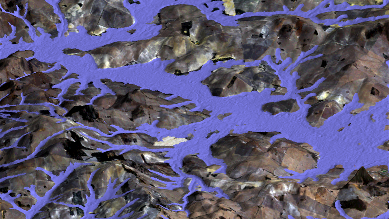
Western Australia’s government agencies working across agriculture, conservation, resource management, planning and development, and emergency services need to know how our State is changing over time. Seeing the ‘big picture’ and recognising changes in vegetation coverage and the impacts of development, salinity and climate change starts with satellite imagery. The Land Monitor Project coordinates the production of vegetation and salinity maps from satellite data, and has tracked vegetation changes over time since 1988. Using the Pawsey Supercomputing Centre, Land Monitor data and products are becoming more readily available to the government agencies that rely on this information to safeguard our State.
The Challenge
Many activities and decisions rely on maps and an understanding of our environment. Having a single repository of this spatial information and understanding how it may change over time is invaluable to many of our government agencies and local industries. The Land Monitor project is a long-term collaboration between Western Australian government agencies to provide this information and update it annually. Initially created through the National Dryland Salinity program, the cross-government consortium now includes:
- Western Australian Land Information Authority (Landgate)
- CSIRO/Data61
- Department of Biodiversity, Conservation and Attractions
- Department of Primary Industries and Regional Development
- Department of Planning, Lands and Heritage
- Department of Water and Environmental Regulation
- Department of Fire and Emergency Services
- Water Corporation.
Dan Sandison from Landgate explains: “CSIRO takes the analysis-ready Landsat satellite imagery from Geoscience Australia and creates a mosaic of the entire area. It then uses algorithms to identify and map the vegetation cover. It does this every year, and then processes the data against the data sets from previous years to create products that show the trends over time. Landgate coordinates the program, and until now has distributed the new data set and map products to all of the consortium partners annually.”
The core products are interactive maps of vegetation extent, change and trends, which can be used and developed further by individual government agencies to suit their particular needs.
Land Monitor originally only covered Western Australia’s southwest agricultural region, but in 2018 expanded to deliver vegetation mapping and monitoring products across the entire State, increasing the area monitored from 18 million to over 252 million hectares per annum. As the Land Monitor program grows – with some products at 25 m spatial resolution now covering the entire State, and being added to every year – making sure everyone who needs access to this resource becomes more difficult.
The Solution
Pawsey is now supporting the Land Monitor program by hosting its entire data repository, from the raw satellite data collected every year, to all of the vegetation and salinity mapping products developed and their trends over time. “Each of the consortium partners can directly access not just the latest data but insights from the entire 30-year monitoring effort as they need it,” said Sandison. “It reduces a lot of duplication, there are no issues with version control as the data set expands, everyone has access to the latest information in its historical context, and they can then use it as they need to.”
The Outcome
Pawsey’s storage and access arrangements for Land Monitor will continue as the State’s ‘satellite snapshot’ gets revisited every year. There is now also significant scope for the mapping and monitoring program to grow.
Land Monitor has also been working with Geoscience Australia to develop the Copernicus Hub in Western Australia, which is also hosted at Pawsey. This allows research on the European Union’s Sentinel satellite series to map the state at 10 m pixel resolution with a more frequent orbit cycle.
Having access to this richer data also means more mapping products will be developed for the consortium partners. “With Pawsey providing such ease of access to the data, it will help us develop more detailed vegetation products, incorporating things like vegetation condition and research into new products, not just vegetation presence or absence over time. And all of our consortium partners will benefit from that new level of awareness of our State’s health.”
Project Leader.
Valley Hazard data
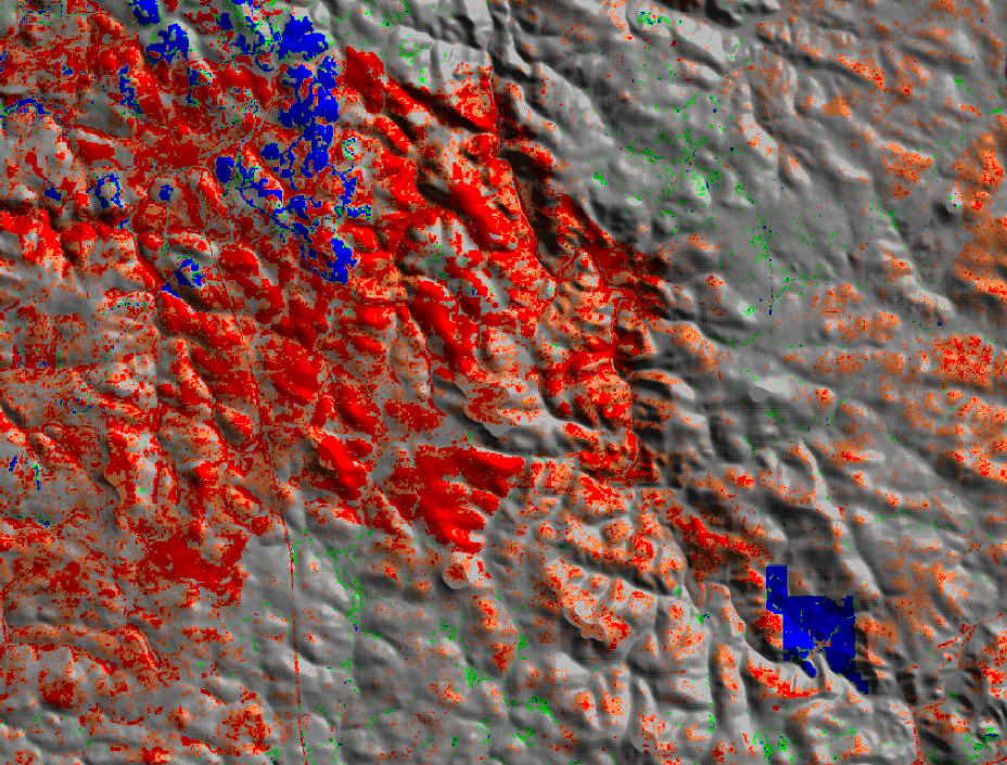
Digital elevation model with vegetation trends